Canada’s Northwest Territories is a part of the country’s north and northwest that includes a sizable amount of tundra and woods. The territories almost completely covered the roof of North America during most of the 20th century and made up more than one-third of Canada’s total land area. They also extended from the country’s eastern to westernmost points. The Northwest Territories’ area was cut in half when Nunavut was formed in 1999 from the territory’s eastern region.
The provinces of Saskatchewan, Alberta, and British Columbia are to the south of the Northwest Territories, Nunavut is to the east, and Yukon is to the west. The biggest islands within the territories, Banks and Prince Patrick, are located high above the Arctic Circle. Other islands, like Victoria and Melville, are shared by the territory and Nunavut. The largest and capital city is Yellowknife. 5.190.735 square miles (1,346,106 square km). Pop. (2021) 41,070.
- The Northwest Territory have the greatest population of all of Canada’s territories at 45,500, although it is just a fourth that of Prince Edward Island, the province with the lowest population. It is 238 times bigger than PEI, though.
- The capital and sole city of the Northwest Territories is Yellowknife. Its population of 22,300 does not place it in Canada’s top 100 cities by population. Yellowknife is home to little under half of the inhabitants in the Northwest Territories.
- Northwest Territorians, People of the North, Northwesters, or Northwesterners are terms used to describe people who live in the Northwest Territories. Indigenous tribes are more likely to use their own name to identify.
- The second largest proportion of any province or territory, after Nunavut, is found in the Northwest Territories, where 51% of the population is indigenous. The majority of them are Métis, Inuvialuit (Western Inuit), and Dene. The Dene and Inuit have a harsh past with one another.
- Because of the territory’s proximity to Rupert’s Land and its location near Hudson’s Bay, the British were the first to use the moniker “North-West Territory.” The phrase was then changed to “North-West Territories” and finally “Northwest Territories.”
- The region has also been referred to as “Canada’s Last Frontier,” “Land of the Polar Bear,” “North of Sixty” (since the 60th parallel is the southern border of the territory), and “The Land of the Midnight Sun” (now used by the Yukon).
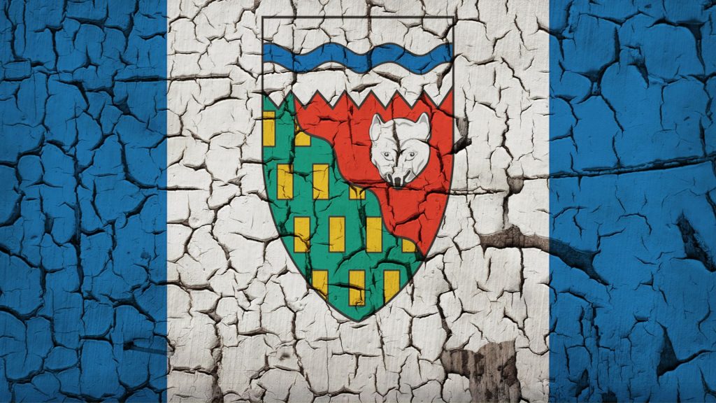
- Blue on the outside, representing the ocean, and white in the inside, representing the snow and ice, make up the Northwest Territories flag. The territory’s coat of arms, which has a white fox, green and yellow trees and minerals in the south on the left, red tundra on the right, and a red and blue wavy tree line on the right, is in the centre.
- Around Tuktoyaktuk, there are around 1350 pingos, which are sizable hills with an ice core rising from the lowlands.
- The fourth natural World Heritage Site overall and the first in Canada was the Nahanni National Park Reserve. It is the location of Virginia Falls, which is regarded as one of Canada’s most magnificent waterfalls and is twice as tall as Niagara Falls.
- Great Bear Lake in the remote Northwest Territories is the biggest lake in Canada overall (excluding the Great Lakes shared with the US) and the eighth-largest lake in the world (seventh if you exclude the Caspian Sea). Additionally, it is the biggest lake near or inside the Arctic Circle.
